Warbird Information Exchange

DISCLAIMER: The views expressed on this site are the responsibility of the poster and do not reflect the views of the management.
It is currently Fri Apr 03, 2026 4:34 pm

All times are UTC - 5 hours


Classic Wings Magazine WWII Naval Aviation Research Pacific Luftwaffe Resource Center
When Hollywood Ruled The Skies - Volumes 1 through 4 by Bruce Oriss


Post new topic Reply to topic  [ 23 posts ]  Go to page 1, 2  Next
Author Message
PostPosted: Mon Oct 12, 2009 10:28 pm 
Offline
1000+ Posts!
1000+ Posts!
User avatar

Joined: Thu Apr 28, 2005 10:01 am
Posts: 1126
Location: Post-Confederate People's Republic of Alabamastan, Suh!
I came across this shot through a friend acquainted with the grandson of the pilot. Capt. Brack Diamond, Jr., 335th, is shown at Debden on his GINNY. While flying GINNY as a 2Lt. he bagged a Bf 109 on 18 August 44 at 1930 hrs. 20 miles NE of Paris. Most sources also credit him with 6 strafing victories for a total of 7 destroyed.


Image


I thought it would be fun to do a quick "Then & Now" with GoogleEarth and a pic from my albums from my visit to Debden in 2002:


Using a GoogleEarth image, the blue arrow pinpoints the location of Diamond's Mustang in 335's double-bay parking revetment. The red arrow shows my location for the accompanying 2002 ground level shot. Both arrows show the general direction the photos were taken.
Image


Overhead modern GoogleEarth view with a "Mustang" inserted approximately where GINNY was parked for the wartime shot.
Image


2002 ground level shot from the peri-track looking down towards the parking bay. Diamond's plane would be in the distance to the extreme left in this view.
Image


If you'd like to see more of Debden "Then & Now" ~
http://www.wademeyersart.com/id32.html

Wade

_________________
Website: http://www.wademeyersart.com
Facebook: http://www.facebook.com/Wade.Meyers.Studios

Image


Top
 Profile  
 
 Post subject:
PostPosted: Mon Oct 12, 2009 11:26 pm 
Offline

Joined: Mon May 28, 2007 7:10 pm
Posts: 648
Location: tempe, az
Thanks, Wade. Very interesting.


Top
 Profile  
 
 Post subject:
PostPosted: Tue Oct 13, 2009 10:01 am 
Offline
2000+ Post Club
2000+ Post Club
User avatar

Joined: Sat Oct 04, 2008 6:57 pm
Posts: 2716
Location: St Petersburg FL, USA
Very cool, that would be a fun place to go metal detecting! Never know what cast off bits would show up! Looks like nature is slowly taking over and given another 20 years there won't be much left to the eye other than a few bumps in the grass.

_________________
Image
Aviation Illustration Website
http://shepartstudio.com/illustration/


Top
 Profile  
 
 Post subject:
PostPosted: Tue Oct 13, 2009 11:10 am 
Offline
Account Suspended
User avatar

Joined: Wed Nov 14, 2007 3:06 pm
Posts: 2713
Sorry, I dont see it.
They look completely different.

Not to be a skeptic, but what reference points did you use?

How did you determine that is where she was taken in the photo?

Nothing in either photos or maps looks remotely like anything in the photo.

:?

Now granted, 60+ years have passed.., but just curious what your methods were so maybe we could use the same!

Cheers,

_________________
S.


Top
 Profile  
 
 Post subject:
PostPosted: Tue Oct 13, 2009 11:39 am 
Offline
2000+ Post Club
2000+ Post Club
User avatar

Joined: Sat Oct 04, 2008 6:57 pm
Posts: 2716
Location: St Petersburg FL, USA
Looks like there are some buildings and aircraft parking areas out there in the background, taking this vintage pic, a vintage map and overlaying with the current existing "hardscape" would do the trick. Wade was there with a guide who would also have local information. He has done in depth study on this field, so he would know!

_________________
Image
Aviation Illustration Website
http://shepartstudio.com/illustration/


Top
 Profile  
 
 Post subject:
PostPosted: Tue Oct 13, 2009 1:51 pm 
Offline

Joined: Sat Sep 23, 2006 3:31 am
Posts: 309
Great photos, love those before and after series, Thanks Chico :supz:


Top
 Profile  
 
 Post subject:
PostPosted: Tue Oct 13, 2009 4:27 pm 
Offline
User avatar

Joined: Wed Jun 16, 2004 7:18 am
Posts: 671
Location: Berkshire, UK
the330thbg wrote:
Sorry, I dont see it.
They look completely different.

Not to be a skeptic, but what reference points did you use?

How did you determine that is where she was taken in the photo?

Nothing in either photos or maps looks remotely like anything in the photo.


Having spent quite a bit of time at Debden, I'd say he's worked it out pretty accurately TBH.
The shadows indicate sun position which dictates which direction you're looking, which pretty much means the the trees and buildings in the background can only be the ones off the Thaxted Road to the NE corner of the airfield, and doesn't look too different to today, or rather than when I was last there which was about 10 years ago.

But, a guy I work with was stationed there for 6 months only about 2 years ago so will show him the thread tomorrow and see if he concurs.


Top
 Profile  
 
 Post subject:
PostPosted: Tue Oct 13, 2009 5:28 pm 
Offline
1000+ Posts!
1000+ Posts!
User avatar

Joined: Thu Apr 28, 2005 10:01 am
Posts: 1126
Location: Post-Confederate People's Republic of Alabamastan, Suh!
Fair question, and deserves an answer ~ :wink:

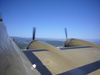
A lot of wartime shots like this look the same - as in, "How in the _______ can you tell where a particular shot is located?" With many shots, you can't. With Debden, however, for those of us intimately familiar with the wartime layout there are more than enough clues to pinpoint the location in this photograph with a fair degree of confidence:

1) It's a 335 kite. That narrows the location on the field - if you know where they parked.

2) No hangars, watch office (control tower), or any of the technical site buildings in the background. Narrows the direction.

3) 335 had only one "offset" two-ship bay (we're getting close).

4) Abbotts Farm in the background (a dead giveaway).

5) 334 parking just where it should be from this direction - right in front of Abbotts Farm. Also, if you look closely (granted, I have a larger image available to me) you can see the N-S runway and peri-track from which I took the ground shot in 2002.

6) And finally, I spent almost a year before my 2002 trip going through every 4th FG photo and airfield diagram I could lay my hands on trying to triangulate details in order to take as many "then and now" shots as I could for my website. I thought I was only going to have one afternoon on the field, so I wanted to be sure of where I needed to be with minimum fuss. As it turned out I had three days, so I got a truckload of pics over and above what I had planned on. I brought cheap photocopies of my "then" shots with me as 'guides'.

As an aside, a few months after my trip we were at Dayton for the 4th FG memorial dedication at the USAF Museum. We were watching a neat film taken by one of the vets from a P-47 if I recall correctly (you could see the wing in the film) as it flew around the airfield. There was some discussion about exactly where a certain portion of the field was located. I looked at it and said, "The film's backwards". The guy who was showing the film, a son of the vet - or one of the veterans - got red-faced and angry at me for daring to challenge him (after all, who was I but an enthusiast?) ... but I was so recently familiar with the field that I *knew* I was right. Not only did I know the film, but I knew the Jugs didn't carry the national insignia on the top of the RIGHT wing! :lol: :lol: The discussion came to an end - and we ended up as friends ...

Hope that answers your question. 8)

Wade

_________________
Website: http://www.wademeyersart.com
Facebook: http://www.facebook.com/Wade.Meyers.Studios

Image


Top
 Profile  
 
 Post subject:
PostPosted: Tue Oct 13, 2009 9:37 pm 
Offline
1000+ Posts!
1000+ Posts!
User avatar

Joined: Thu Apr 28, 2005 10:01 am
Posts: 1126
Location: Post-Confederate People's Republic of Alabamastan, Suh!
Firebird wrote:
... The shadows indicate sun position which dictates which direction you're looking, which pretty much means the the trees and buildings in the background can only be the ones off the Thaxted Road to the NE corner of the airfield, and doesn't look too different to today.


I saw your note earlier and meant to second the "sun position" clue. BTW, for those who may be curious the facility near the old revetment in question in the GoogleEarth pics is the radar station for nearby Stansted airport. Naturally not there during the war, but the tall radar structure sure makes a definite shadow for our purposes! 8)

Cheers!
Wade

_________________
Website: http://www.wademeyersart.com
Facebook: http://www.facebook.com/Wade.Meyers.Studios

Image


Top
 Profile  
 
 Post subject:
PostPosted: Wed Oct 14, 2009 5:06 am 
Offline
3000+ Post Club
3000+ Post Club
User avatar

Joined: Fri Apr 30, 2004 11:44 am
Posts: 3293
Location: Las Vegas, NV
Awww, Wade...I thought you were talking about something else when you wrote "then and now".


Top
 Profile  
 
 Post subject:
PostPosted: Wed Oct 14, 2009 5:37 am 
Offline
Long Time Member
Long Time Member
User avatar

Joined: Tue May 11, 2004 5:42 pm
Posts: 6884
Location: The Goldfields, Victoria, Australia
Chicoartist wrote:
6) And finally, I spent almost a year before my 2002 trip going through every 4th FG photo and airfield diagram I could lay my hands on trying to triangulate details in order to take as many "then and now" shots as I could for my website. I thought I was only going to have one afternoon on the field, so I wanted to be sure of where I needed to be with minimum fuss. As it turned out I had three days, so I got a truckload of pics over and above what I had planned on. I brought cheap photocopies of my "then" shots with me as 'guides'.

And - note the wing mirror in the photograph, Watson - after all that work, the gentleman in question didn't even get our of his motorised conveyance.

Image

I deduce he was an American. :)


Just funnin' you, as Mr Mudge would say. ;)

Great little thread.

_________________
James K

"Switch on the underwater landing lights"
Emilio Largo, Thunderball.

www.VintageAeroWriter.com


Top
 Profile  
 
 Post subject:
PostPosted: Wed Oct 14, 2009 6:43 am 
Offline
2000+ Post Club
2000+ Post Club
User avatar

Joined: Sat Oct 04, 2008 6:57 pm
Posts: 2716
Location: St Petersburg FL, USA
It was a drive-by shooting, Gangsta' Style! :lol:

_________________
Image
Aviation Illustration Website
http://shepartstudio.com/illustration/


Top
 Profile  
 
 Post subject:
PostPosted: Wed Oct 14, 2009 9:15 am 
Offline
3000+ Post Club
3000+ Post Club
User avatar

Joined: Fri May 07, 2004 10:10 pm
Posts: 4435
Location: Maypearl, Texas
Well done Det. Wade, is it still an active airfield??

Lynn


Top
 Profile  
 
 Post subject:
PostPosted: Wed Oct 14, 2009 9:51 am 
Offline
1000+ Posts!
1000+ Posts!
User avatar

Joined: Thu Apr 28, 2005 10:01 am
Posts: 1126
Location: Post-Confederate People's Republic of Alabamastan, Suh!
Lynn Allen wrote:
Well done Det. Wade, is it still an active airfield??

Lynn


Debden airfield, now known as "Carver Barracks", has been under military control since the war. It is currently the home of 33 Engineer Regiment (EOD). They train personnel on site from all over the world, including US forces, in the art and science of EOD. Aside from constant TDYs to serve as expert consultants in the war zones to allied forces, they told me they are STILL called out to the London area on occasion to demil bombs from WWII that are found whilst moving earth for construction. Carver Barracks is a busy Army base - I'm sure they do more than I've covered above.

No active flying takes place on the site, but the main (E-W) runway is theoretically maintained to handle C-130 class transports, but they kind of 'winked' at that one ... 8)

As you can see from the GoogleEarth aerials, the wartime 'floor plan' of the runways and all peri-tracks is remarkably complete. IIRC, I found it to be actually the most "true to wartime" layout of asphalt over concrete of any of the 8th AF bases that I researched prior to my trip. Aside from the temporary wooden buildings serving as wartime dispersal huts and briefing rooms that are of course long gone, if you are familiar with the wartime layout you can easily go all around the field spotting the site of famous pics, etc.

Bassingbourn is in very similar condition, but about half of the wartime runway and peri-track square footage at the former home of the 91st Bomb Group are missing. Both Bassingbourn and Debden have remarkably intact WWII-era structures in the technical/admin sites, but that is rapidly changing ...

Wade

_________________
Website: http://www.wademeyersart.com
Facebook: http://www.facebook.com/Wade.Meyers.Studios

Image


Top
 Profile  
 
 Post subject:
PostPosted: Wed Oct 14, 2009 1:07 pm 
Offline
User avatar

Joined: Wed Jun 16, 2004 7:18 am
Posts: 671
Location: Berkshire, UK
Debden is also used a lot for motorsports events.....and the reason I've spent a lot of time there.

If you look closely at the Google Earth image posted earlier, you can see the marks in the tarmac on the north section of the north-south runway and nearby peri track from the sprint course that exists there (for those of you in the USA, sprinting is similar to autocross)

Here's a shot taken in 2007 at one of the Debden Sprint events. Taken from the junction of the two runways, looking north up the north-south runway.

Image


Top
 Profile  
 
Display posts from previous:  Sort by  
Post new topic Reply to topic  [ 23 posts ]  Go to page 1, 2  Next

All times are UTC - 5 hours


Who is online

Users browsing this forum: k5083 and 109 guests


You cannot post new topics in this forum
You cannot reply to topics in this forum
You cannot edit your posts in this forum
You cannot delete your posts in this forum
You cannot post attachments in this forum

Search for:
Jump to:  
Powered by phpBB® Forum Software © phpBB Group