jdvoss wrote:
I cannot tell if this site is the extreme eastern end of MCAS Ewa or the western end of NS Pearl Harbor.
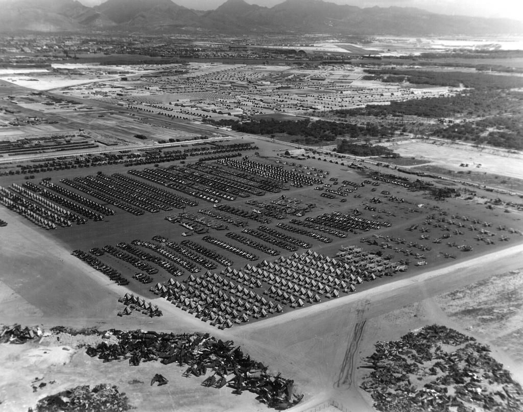
Interesting question. I propose that the photo was taken just East of MCAS Ewa and looks almost due east, so East of Ewa, more in the Wesetern Area of Pearl/Iroquios Point area. I was not aware of this massive a parking area for aircraft around here. The main scrap yard would seem to be known as Eva Beach today. Air craft could have been easily towed from MCAS Ewa to this area. I think we see the main entrance to Pearl Harbor running directly horizontally across the photo from the 10 o'clock postion to the 2 o'clock, so again think we are a bit east of MCAS Ewa proper, or Barbers Point. Main part of Pearl Harbor and West Lock off camera to the left. Hickam is across the channel and is the black airfield in upper right, one o'clock.
The main road running from 10'oclock to 4/ o'clock is perhaps N road in modern day Eva Beach (switching names to 12th on the Naval Reservation) And the diagonal road starting at 10 o'clock running toward the channel is Bravo road.
I'm by no means a photo intepreter, so offered with caution.